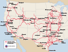
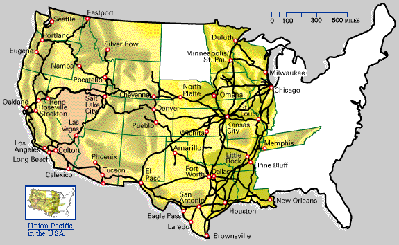
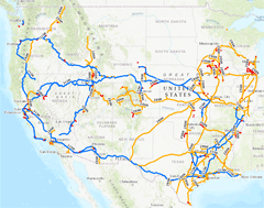
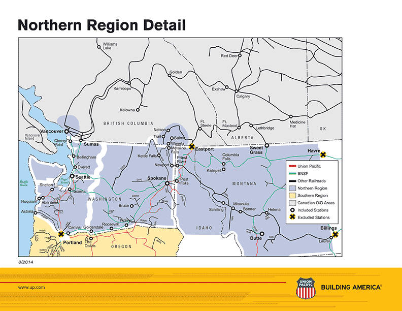
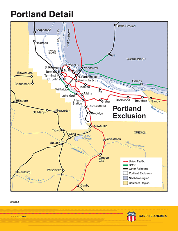
Union Pacific System Map
Expanded views of various system map segments
Union Pacific Maps
Current Public Union Pacific Maps
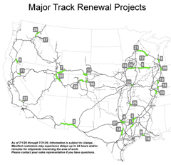
Major Track Renewal Projects
Locations where maintenance work may impact shipments.
(Map is updated monthly.)
Locations where maintenance work may impact shipments.
(Map is updated monthly.)

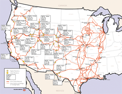
Union Pacific Common Line Names
Locations and common names of key railroad lines.
GIF version
PDF version
Locations and common names of key railroad lines.
GIF version
PDF version
Union Pacific Highest Elevations
Highest and lowest geographical rail elevations on the Union Pacific system.
Highest and lowest geographical rail elevations on the Union Pacific system.
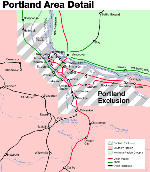
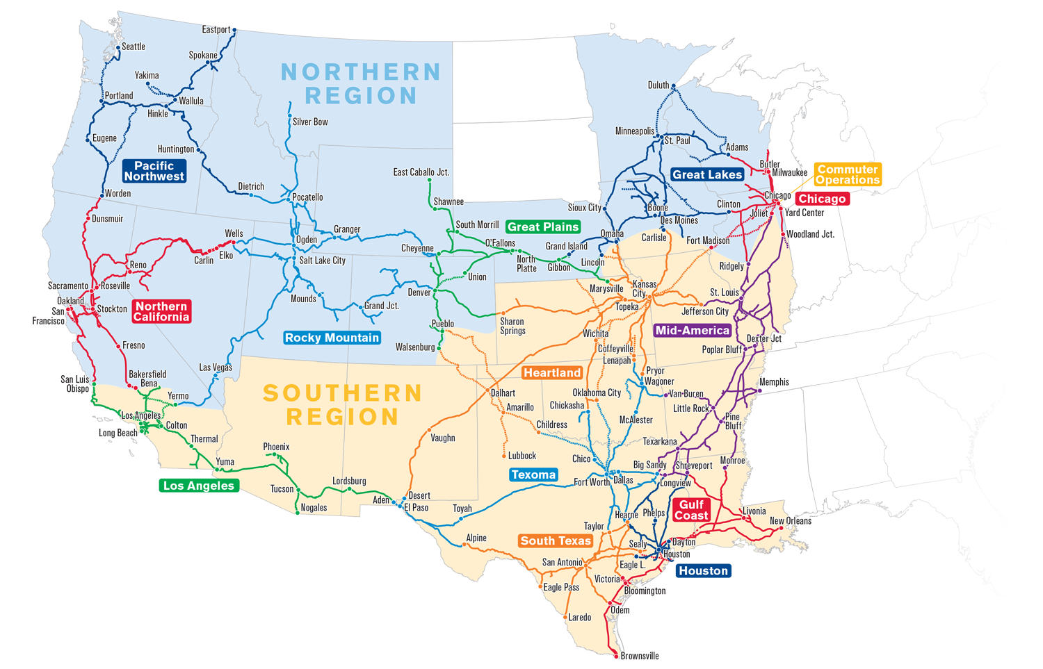
Union Pacific Service Unit and Regions Map
Operating territories responsible for specific portions of the railroad.
PNG version
PDF version
Operating territories responsible for specific portions of the railroad.
PNG version
PDF version
U.S. Guide to the Union Pacific Railroad
Individual depictions of Union Pacific in each of the 23 states of our system.
Individual depictions of Union Pacific in each of the 23 states of our system.
Union Pacific Allowable Gross Weight
Weight capacities of railroad lines.
Weight capacities of railroad lines.
Union Pacific Historical Maps
Sacramento to Ogden, 1856-1869
Original construction dates of the Central Pacific Railroad route
GIF version
PDF version
Original construction dates of the Central Pacific Railroad route
GIF version
PDF version
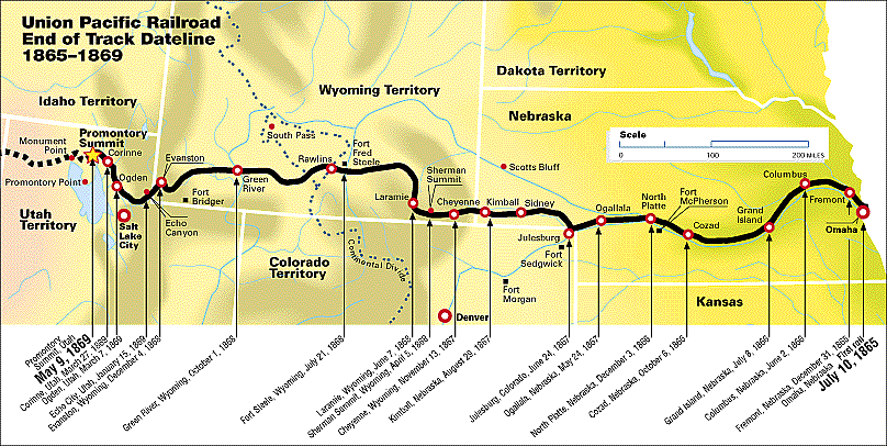
UP End of Track Dateline, 1865-1869
Historic construction timeline of the original Union Pacific overland route
GIF version
PDF version
Historic construction timeline of the original Union Pacific overland route
GIF version
PDF version