The Union Pacific Museum archives contain more than 500,000 images. A small sampling is shown in this photo gallery. These images may not be downloaded or used for any commercial purpose without specific written permission from Union Pacific.

Publishers or production companies who wish to use Union Pacific images should contact the museum at (402) 501-3841 for additional assistance. Information also is available on our Order Form.
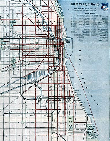
Historic plat map of the Chicago area highlighting Union Pacific rail lines, property boundaries, and infrastructure layout with detailed labeling.
Historic map showing Union Pacific railroad routes through the Black Hills region, with labeled towns, rail lines, and topographical features.
Historic map of Nebraska displaying Union Pacific railroad routes, surrounding towns, and geographic features, with detailed annotations and route markings.
Historic map showing the proposed Denver Pacific Railway route connecting Denver to the Union Pacific main line, with regional towns and topographical details.
Map from 1869 depicting the completed transcontinental railroad route across the United States, showing the Union Pacific and Central Pacific lines meeting at Promontory Summit.
Detailed historical map from around 1869 showing the full transcontinental railroad route, with surrounding territories, state boundaries, and connecting lines.
Map illustrating federal land grants allocated to Union Pacific and other railroads, with color-coded sections along the railroad routes across the western United States.
Historic map of the Los Angeles region showing Union Pacific rail lines, property divisions, and infrastructure details within the city and surrounding area.
Map of Omaha, Nebraska from 1866, showing early Union Pacific rail facilities, street grid layout, and urban development near the Missouri River.